Wednesday, September 17, 2008

Infrared Aerial Photo


Infrared photos are exceptionally well suited for detecting unusual and extreme environments.

Cartographic Animations


An animated map. In this case depicting the percent of births to Mothers under age 20.

Statistical Map

Statistical Map
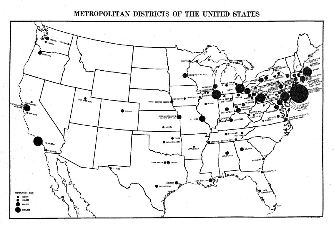
Maps to define areas based on the metropolitan area concept.
Throughout the period 1910 through 1940, the Census Bureau defined metropolitan districts in terms of minor civil divisions (MCDs)—county subdivisions such as townships or election districts—and determined their boundaries primarily based on population density.

Cartograms


Cartograms

A diagrammatic map on which statistical information is represented by shading and symbols. A cartogram is a map on which the area of each division is proportional to some value other than its land area. This Cartogram is depicting Electoral Votes for 2004.

Flow Map


Flow Map

Flow maps show the movement of objects from one location to another.

Isolines Map


It easily shows the distribution of the subject matter. In this case it is the temperatures.